

Introduction
The government, in collaboration with municipalities in the eclipse’s path of totality, has selected sites that meet safety and capacity standards as recommended observation points.
These are spacious areas with safe access and mobility, featuring excellent visibility conditions, and they prioritise the protection of the natural environment as well as the logistical feasibility and provision of minimum services to accommodate large crowds of people.
View the 20 selected locations and key features for each on this map:
Alcanar
Altafulla
Amposta
Camarles
Cambrils
Constantí
Gandesa
L'Aldea
L'Ametlla de Mar
les Borges Blanques
Lleida
Montbrió del Camp
Móra la Nova
Reus
Santa Bàrbara
Tarragona
Torredembarra
Valls
Visibility Map
The path of totality for a solar eclipse is typically very narrow, which is why it is crucial to know precisely which points in the territory will experience this totality phase.
To provide accurate, up-to-date information, the IEEC – in partnership with the Government of Catalonia via the Ministry for Research and Universities – has created an interactive visibility map. Below, you can consult this map, which allows you to clearly and precisely identify the areas where the eclipse will be observable under the best conditions and plan your experience accordingly.
Municipality search tool
To aid planning for the 2026 solar eclipse, consult this detailed ephemeris table by municipality.
This table lists exact timings for eclipse stages: start, totality begin, maximum, totality end, eclipse end (sunset), totality duration, and Sun’s height at maximum.
Thanks to this information, you will be able to know precisely how the eclipse will appear from each locality and plan your observation with safety and accuracy.
Sky simulation map during the eclipse
We also offer an interactive map simulating the sky during the 2026 solar eclipse. This resource enables the visualisation of the positions of the planets and the brightest stars at the time of the event, making it easier to identify the main visible celestial objects.
In this way, the observation of the eclipse can be complemented by a more comprehensive view of the sky, providing additional reference information for all interested individuals.
You can download the free Stellarium Mobile app for your device:


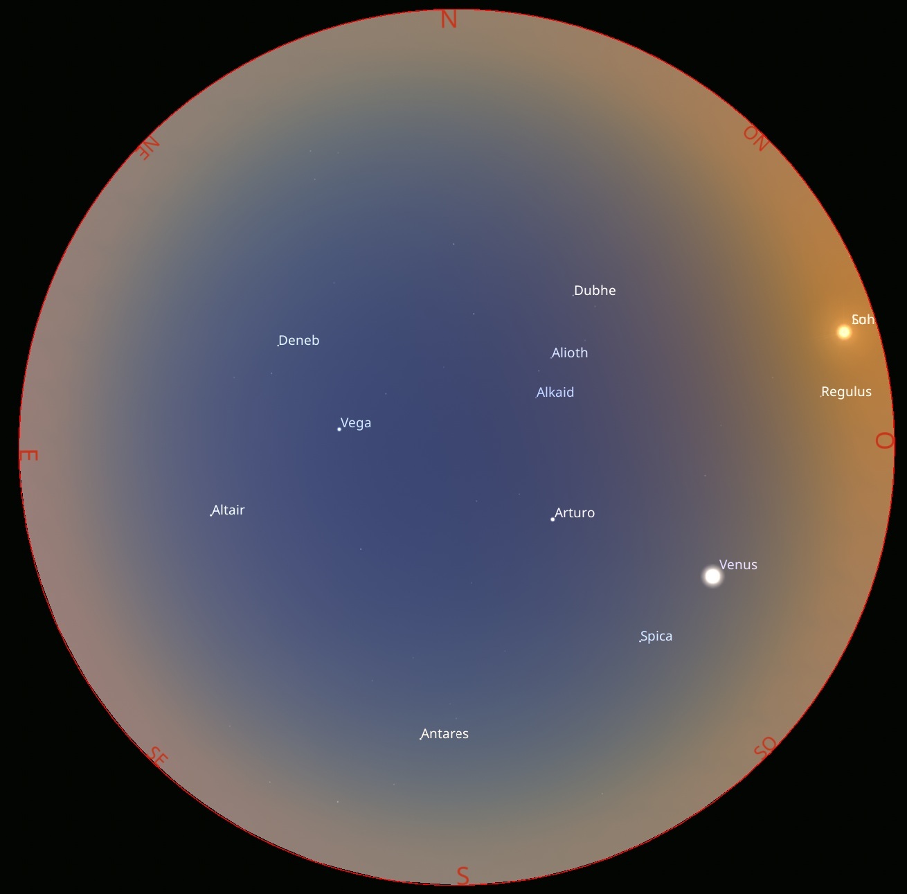
Stellarium web view / Stellarium